


Voting District 10, Cherokee County, Oklahoma
About
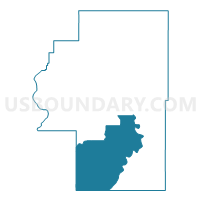
Outline

Summary
| Unique Area Identifier | 653661 |
| Name | Voting District 10 |
| County | Cherokee County |
| State | Oklahoma |
| Area (square miles) | 124.52 |
| Land Area (square miles) | 115.91 |
| Water Area (square miles) | 8.62 |
| % of Land Area | 93.08 |
| % of Water Area | 6.92 |
| Latitude of the Internal Point | 35.74234460 |
| Longtitude of the Internal Point | -95.01840390 |
Maps


Graphs
Select a template below for downloading or customizing gragh for Voting District 10, Cherokee County, Oklahoma


Neighbors
Neighoring Voting District (by Name) Neighboring Voting District on the Map
- Voting District 19, Cherokee County, OK
- Voting District 2, Cherokee County, OK
- Voting District 20, Cherokee County, OK
- Voting District 209, Sequoyah County, OK
- Voting District 21, Cherokee County, OK
- Voting District 210, Sequoyah County, OK
- Voting District 22, Cherokee County, OK
- Voting District 40, Muskogee County, OK
- Voting District 44, Muskogee County, OK
- Voting District 6, Cherokee County, OK
- Voting District 9, Cherokee County, OK
Top 10 Neighboring County Subdivision (by Population) Neighboring County Subdivision on the Map
- Muskogee CCD, Muskogee County, OK (55,694)
- Vian CCD, Sequoyah County, OK (8,077)
- South Cherokee CCD, Cherokee County, OK (6,388)
- East Cherokee CCD, Cherokee County, OK (6,153)
Top 10 Neighboring Place (by Population) Neighboring Place on the Map
- Tahlequah city, OK (15,753)
- Park Hill CDP, OK (3,909)
- Pettit CDP, OK (954)
- Tenkiller CDP, OK (633)
- Keys CDP, OK (565)
- Zeb CDP, OK (497)
- Sour John CDP, OK (60)
Top 10 Neighboring Elementary School District (by Population) Neighboring Elementary School District on the Map
- Keys Public Schools, OK (4,534)
- Woodall Public School, OK (1,479)
- Tenkiller Public School, OK (1,475)
Top 10 Neighboring Unified School District (by Population) Neighboring Unified School District on the Map
Top 10 Neighboring State Legislative District Lower Chamber (by Population) Neighboring State Legislative District Lower Chamber on the Map
- State House District 4, OK (37,367)
- State House District 15, OK (35,338)
- State House District 14, OK (34,906)
Top 10 Neighboring State Legislative District Upper Chamber (by Population) Neighboring State Legislative District Upper Chamber on the Map
Top 10 Neighboring 111th Congressional District (by Population) Neighboring 111th Congressional District on the Map
Top 10 Neighboring Census Tract (by Population) Neighboring Census Tract on the Map
- Census Tract 14, Muskogee County, OK (7,207)
- Census Tract 9783, Cherokee County, OK (6,388)
- Census Tract 9782.02, Cherokee County, OK (3,256)
- Census Tract 9782.01, Cherokee County, OK (2,897)
- Census Tract 302.01, Sequoyah County, OK (2,568)
Top 10 Neighboring 5-Digit ZIP Code Tabulation Area (by Population) Neighboring 5-Digit ZIP Code Tabulation Area on the Map
- 74464, OK (30,111)
- 74434, OK (9,067)
- 74962, OK (5,092)
- 74451, OK (4,283)
- 74435, OK (3,185)
- 74471, OK (1,800)
- 74427, OK (1,383)
- 74423, OK (872)